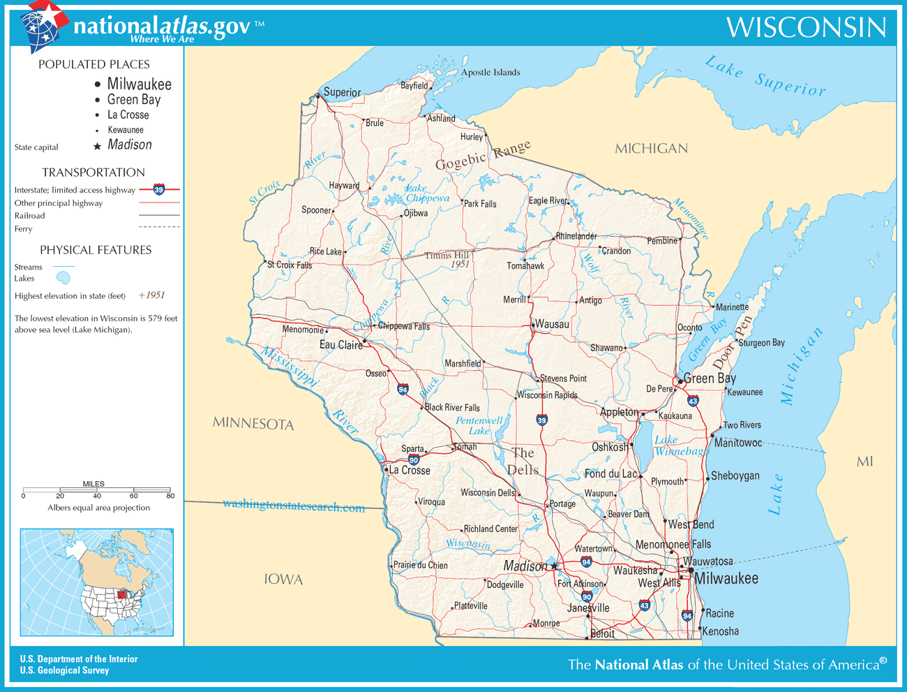
A large detailed map of Wisconsin State
This is a large, detailed map of Wisconsin. There are links to many Wisconsin localities below. Our website format reduces the display size for uniformity. Here is a link to the full-size image that is more easily readable.
View our Wisconsin State county map
Wisconsin State Map
Explore Wisconsin with an interactive map featuring Street View, satellite and terrain views. Live weather, local news and location details for Wisconsin — plus links to detailed street maps for 923 cities and towns across the state.
Map search is available for a limited number of queries per session to manage costs. Be specific — search precisely for best results.
| State | Wisconsin |
| Capital | Madison |
| Largest City | Milwaukee |
| Country | United States of America |
| Statehood | 1848 |
| Nickname | Badger State |
| Latitude | 44.174 |
| Longitude | -89.6238 |
| Population | 5,893,718 |
| Cities & Towns | 923 |
| Counties | 72 |
| County Map | Wisconsin County Map |
About Wisconsin
Wisconsin unfurls across a varied American landscape, its contours shaped by ancient geological forces and the persistent sculpting of water. From the rugged, unglaciated terrain of the Driftless Area in the southwest, where bluffs rise sharply and valleys plunge deep, to the flat, fertile plains of the southeast and the sandy, pine-scented reaches of the North Woods, the state offers a study in contrasts. The Great Lakes form a significant border, with the vast expanse of Lake Michigan to the east, its shores dotted with both bustling harbors and quiet, wave-worn beaches, and the even grander, colder waters of Lake Superior defining its northern edge. Rivers, like the mighty Wisconsin and the St. Croix, snake through the land, carving their own paths and providing vital arteries for both nature and human endeavor. The air here, especially in the early morning before the sun has fully claimed the sky, often carries a cool, damp scent of earth and foliage, a palpable reminder of the moisture that feeds its abundant life.
The human story of Wisconsin is a deep and layered one, beginning with the Indigenous nations who called this land home for millennia. Tribes such as the Ojibwe, Menominee, Ho-Chunk, and Potawatomi developed rich cultures and sustainable ways of life, intimately connected to the forests, waters, and prairies. European contact brought explorers and traders, followed by waves of settlers drawn by the promise of fertile land and abundant resources. German, Polish, and Scandinavian immigrants, among others, left an indelible mark, their languages, traditions, and architectural styles still visible in the network of small towns that dot the countryside. The territory achieved statehood in 1848, and the subsequent decades saw rapid development, fueled by agriculture, logging, and burgeoning industries, all contributing to the unique character of the Badger State. The sheer tenacity of these early communities, carving lives out of the wilderness, is a persistent undercurrent in the state's collective memory.
Wisconsin's economy has long been rooted in the earth, a legacy deeply entwined with its agricultural prowess. The state is synonymous with dairy farming, its rolling pastures and red barns iconic symbols of its commitment to producing high-quality milk and cheese, a tradition honored in the ubiquitous Friday night fish fry, often featuring local catches. Beyond dairy, the fertile soil supports a diverse range of crops, from corn and soybeans to cranberries, which are cultivated in vast bogs. Historically, logging was a dominant industry, shaping the landscape and fostering the growth of frontier towns. Today, while agriculture remains a cornerstone, Wisconsin has diversified, with strong manufacturing sectors, particularly in machinery and food processing, and a growing presence in technology and healthcare, demonstrating an adaptability that mirrors the changing seasons.
The cultural pulse of Wisconsin beats with a distinct rhythm, a blend of Midwestern practicality and a deep appreciation for the simple pleasures. Sports, both collegiate and professional, hold a prominent place, with a fervent passion for football and baseball that unites communities. Music, from the lively polka of its German heritage to the contemporary sounds echoing from its cities, fills the air. The state's literary landscape, though perhaps less overtly celebrated, reflects its people and places, capturing the quiet resilience and understated beauty of its communities. The pace of life, while varied from urban centers to rural hamlets, often favors a groundedness, a connection to the land and to neighbors, where conversations might linger over coffee and the changing light at dusk over a quiet lake can still evoke a profound sense of peace.
Wisconsin City and Town Maps
A
B
C
D
E
F
G
H
I
J
K
L
M
N
O
P
R
S
T
U
V
W
Z
Wisconsin Maps — Interactive Map, Street View, Weather & Local News
This page provides an interactive Google map of Wisconsin (WI) with Street View, satellite and terrain views, alongside links to detailed street maps for 923 cities and towns across the state. The state capital is Madison and the largest city is Milwaukee, with a state population of approximately 5,893,718.
Every city and town map page includes an embedded street and satellite map together with live weather. National Weather Service forecasts are combined with Open-Meteo graphical data including current conditions, an hourly outlook and a 7-day forecast. Local and world news feeds, Wikipedia location summaries and editorially written descriptions are included where available.
Location data is sourced from the USGS GNIS database and the SimpleMaps US Cities dataset, verified by coordinates rather than name matching alone.
