A large detailed map of West Virginia State Counties
Explore West Virginia with an interactive map featuring Street View, satellite and terrain views. Browse all 55 counties of West Virginia below, with links to every city and town map page. Live weather and local news are included on every location page.
View our West Virginia State map
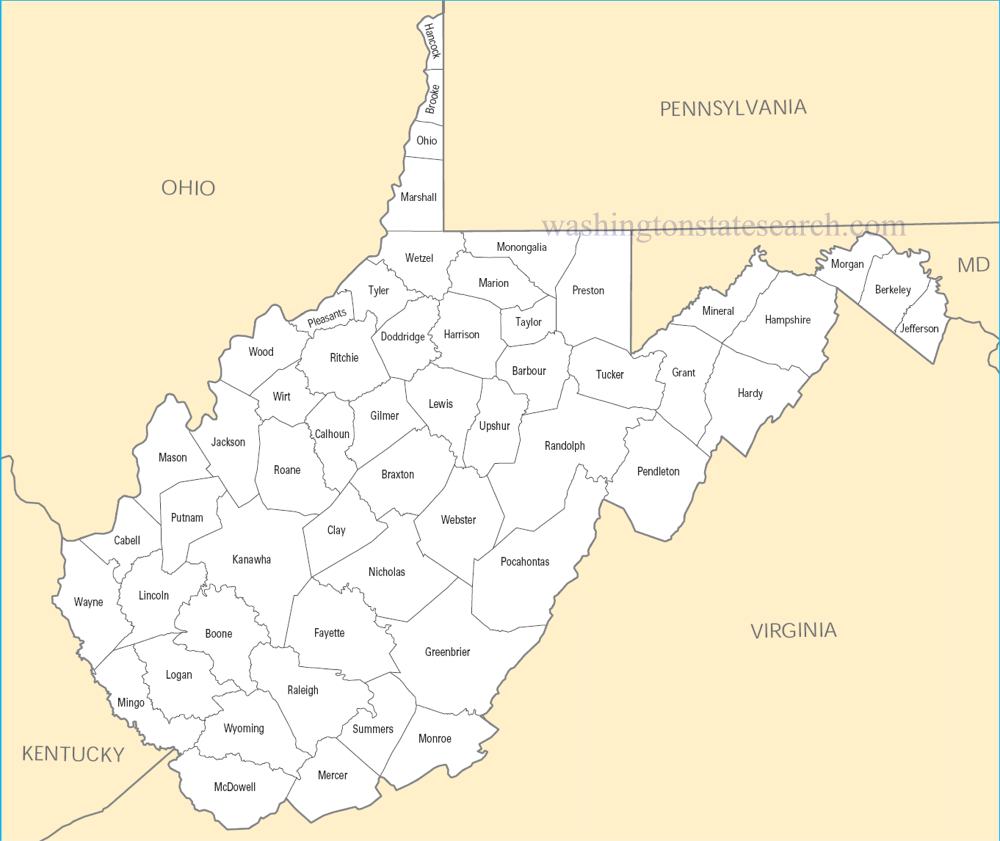
from the National Atlas of the United States
United States Department of the Interior
West Virginia State Map
Map search is available for a limited number of queries per session to manage costs. Be specific — search precisely for best results.
| State | West Virginia |
| Capital | Charleston |
| Country | United States of America |
| Counties | 55 |
| Latitude | 38.5986 |
| Longitude | -80.8699 |
| Cities & Towns | 439 |
| State Map | West Virginia Maps |
About West Virginia
West Virginia unfolds as a landscape sculpted by ancient forces, a place where the Appalachian Mountains rise in an unbroken succession of wooded ridges and deep hollows. This is a land defined by its topography, where the Monongahela, Kanawha, and Ohio rivers carve their paths, offering arteries of life and commerce through the interior. The state’s varied elevations create distinct microclimates, from the cooler, higher peaks that often wear a crown of mist at dawn, to the more temperate valleys where settlements have long clung to the fertile earth. The eastern panhandle, with its Shenandoah Valley proximity, presents a different character than the rugged, coal-rich southwest, a testament to the geological drama that shaped this nearly-heavenly expanse.
The story of West Virginia is one of resilience and reinvention, beginning long before European eyes surveyed its wild beauty. Indigenous nations, familiar with the intricate network of game trails and waterways, were the first stewards of this land. The arrival of European settlers, seeking opportunity and refuge, brought both progress and conflict, eventually leading to the formation of the state during the crucible of the Civil War. This separation from Virginia, a profound act of self-determination, forged a singular identity rooted in independence and a fierce attachment to the homeland. The echoes of coal camps and the tireless work of those who mined its depths remain a palpable presence, woven into the very soul of West Virginia.
The economic lifeblood of West Virginia has long been drawn from the earth, most notably from its abundant coal seams, a resource that fueled industrial expansion across the nation. While coal remains a significant, albeit transformed, industry, the state has diversified its agricultural output, with apples, dairy, and timber playing crucial roles. The clear, rushing waters that tumble down the mountainsides are increasingly recognized for their recreational and aesthetic value, drawing visitors and supporting a growing tourism sector. This ongoing evolution reflects a persistent spirit of adaptation, a recognition that the land’s bounty can be harvested in myriad ways, sustaining communities through changing times.
The cultural character of West Virginia is as distinctive as its mountain vistas, a vibrant blend of tradition and tenacious spirit. Mountain music, with its heartfelt narratives and driving rhythms, forms a core of its artistic expression, resonating from front porches and festival stages alike. The pace of life here is often measured by the slow turning of seasons and the familiar cadence of neighborly discourse, a welcome contrast to the hurried world beyond its borders. Whether cheering for its fiercely loyal collegiate sports teams or sharing a meal of hearty, home-cooked fare, the people of West Virginia possess a profound sense of place, an enduring pride in their Appalachian heritage.
West Virginia Cities and Towns by County
Fayette County
Greenbrier County
Harrison County
Kanawha County
Logan County
Marion County
Mason County
Mingo County
Monongalia County
Preston County
Raleigh County
Randolph County
Wood County
West Virginia County Maps & Location Information
This page provides an interactive Google map of West Virginia (WV) with Street View, satellite and terrain views, alongside links to detailed street maps for all 439 cities and towns across the state organised by county. West Virginia has 55 counties, with the state capital at Charleston.
Every locality page includes an embedded street and satellite map alongside live weather where available — combining National Weather Service forecasts with Open-Meteo graphical data including hourly observations and 7-day outlooks. Local and world news feeds, Wikipedia summaries and editorially written descriptions are included where available.
Location data is sourced from the USGS GNIS database and the SimpleMaps US Cities dataset, verified by coordinates rather than name matching alone.
