A large detailed map of Vermont State
This is a large, detailed map of Vermont. There are links to many Vermont localities below. Our website format reduces the display size for uniformity. Here is a link to the full-size image that is more easily readable.
View our Vermont State county map
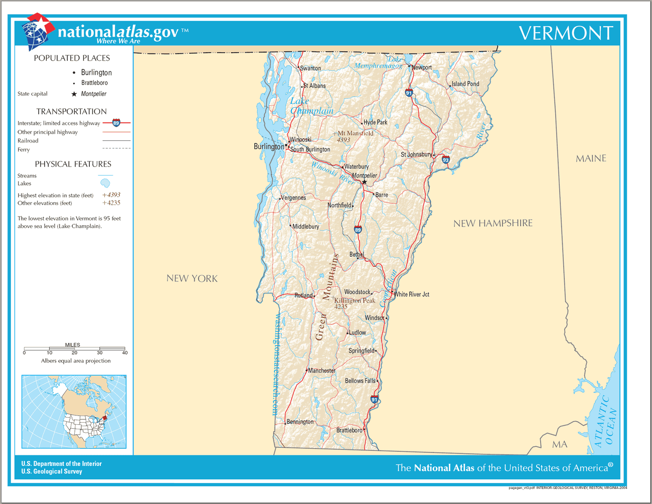
Vermont State Map
Explore Vermont with an interactive map featuring Street View, satellite and terrain views. Live weather, local news and location details for Vermont — plus links to detailed street maps for 107 cities and towns across the state.
Map search is available for a limited number of queries per session to manage costs. Be specific — search precisely for best results.
| State | Vermont |
| Capital | Montpelier |
| Largest City | Burlington |
| Country | United States of America |
| Statehood | 1791 |
| Nickname | Green Mountain State |
| Latitude | 43.9322 |
| Longitude | -72.7011 |
| Population | 643,077 |
| Cities & Towns | 107 |
| Counties | 14 |
| County Map | Vermont County Map |
About Vermont
Vermont unfolds as a landscape sculpted by ancient forces and tempered by the seasons. Its spine is the Green Mountains, a verdant range that cleaves the state, their summits often softened by a haze of distance, their slopes a mosaic of hardwood and pine. To the west, the broad, shimmering expanse of Lake Champlain forms a natural boundary, its waters reflecting the ever-changing sky, while to the east, the Connecticut River carves a gentler course, feeding fertile valleys where dairy farms have long been the lifeblood of the land. This terrain, a symphony of peaks and hollows, of broad rivers and intimate brooks, creates distinct regions, each with its own subtle variations in light and air, from the rugged beauty of the Northeast Kingdom to the more settled agricultural heartlands.
The story of Vermont is one of resilience and self-determination, a narrative that begins with the Abenaki people who knew this land intimately, their lives attuned to the rhythms of the forests and waterways. European settlement arrived with the promise of opportunity, but also with conflict and the eventual struggle for independence from competing colonial claims. This fiercely independent spirit culminated in the establishment of Vermont as a republic, a unique chapter in American history before its eventual admission to the Union. The echoes of those formative years, of pioneers carving out lives from the wilderness and of a people fiercely guarding their autonomy, can still be felt in the quiet dignity of its villages and the enduring self-reliance of its residents.
Agriculture has long been the bedrock of Vermont's economy, a tradition deeply rooted in the fertile soil and the demanding yet rewarding climate. Maple sugaring, a practice as old as the state itself, transforms the crisp spring air into liquid gold, a sweet testament to the land's bounty. Dairy farms, their silos standing like sentinels against the horizon, have historically sustained many communities, their milk flowing to markets far and wide. Beyond agriculture, a growing sector of artisans and craftspeople, alongside innovative small businesses and a burgeoning outdoor recreation industry, contribute to Vermont's economic vitality, a blend of time-honored practices and forward-thinking enterprise.
The cultural character of Vermont is as distinctive as its geography, a reflection of its independent spirit and its deep connection to the natural world. There is a quiet cadence to life here, a pace that allows for reflection and a keen appreciation for the simple beauties that surround us. This is a place where literature finds inspiration in the very texture of the land, where music can be heard in the murmur of a summer breeze or the call of a distant train. While professional sports might be a distant aspiration, a robust culture of collegiate athletics and a deep-seated passion for outdoor pursuits – from skiing and hiking to fishing and cycling – define the active spirit of Vermonters, a people who find joy in the ever-present embrace of their remarkable state.
Vermont City and Town Maps
B
D
E
G
H
L
N
P
Q
R
S
W
Vermont Maps — Interactive Map, Street View, Weather & Local News
This page provides an interactive Google map of Vermont (VT) with Street View, satellite and terrain views, alongside links to detailed street maps for 107 cities and towns across the state. The state capital is Montpelier and the largest city is Burlington, with a state population of approximately 643,077.
Every city and town map page includes an embedded street and satellite map together with live weather. National Weather Service forecasts are combined with Open-Meteo graphical data including current conditions, an hourly outlook and a 7-day forecast. Local and world news feeds, Wikipedia location summaries and editorially written descriptions are included where available.
Location data is sourced from the USGS GNIS database and the SimpleMaps US Cities dataset, verified by coordinates rather than name matching alone.
