Satellite Image of Mount Egmont/Taranaki
Photo Gallery Categories
Home > NZ Photographs > Taranaki > Satellite image of Mount Egmont / Taranaki
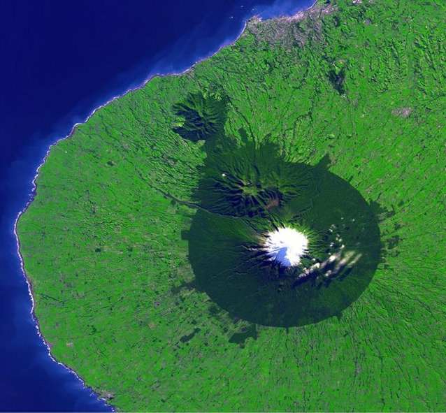
Satellite image of Mount Taranaki from the NASA Earth Observatory showing the nearly-circular Egmont National park surrounding it. New Plymouth is the grey area on the northern coast.
Egmont National Park, in New Zealand, is dominated by the extinct volcano of Mt. Taranaki. Since the area has a high rainfall rate and mild coastal climate there is a lush rainforest covering the foothills, changing to subalpine and alpine shrublands at high elevations, which are in stark contrast to the surrounding pasture farmlands. Mt. Taranaki was first named Mt. Egmont by Captain Cook.
See Also: Taranaki District
From NASA Earth Observatory
This full-resolution simulated natural color Advanced Spaceborne Thermal Emission and Reflection Radiometer (ASTER) image covers an area of 53.4 x 49.4 km with a spatial resolution of 15 meters per pixel, and was acquired on May 27, 2001.