A large detailed map of Louisiana State
This is a large, detailed map of Louisiana. There are links to many Louisiana localities below. Our website format reduces the display size for uniformity. Here is a link to the full-size image that is more easily readable.
View our Louisiana State county map
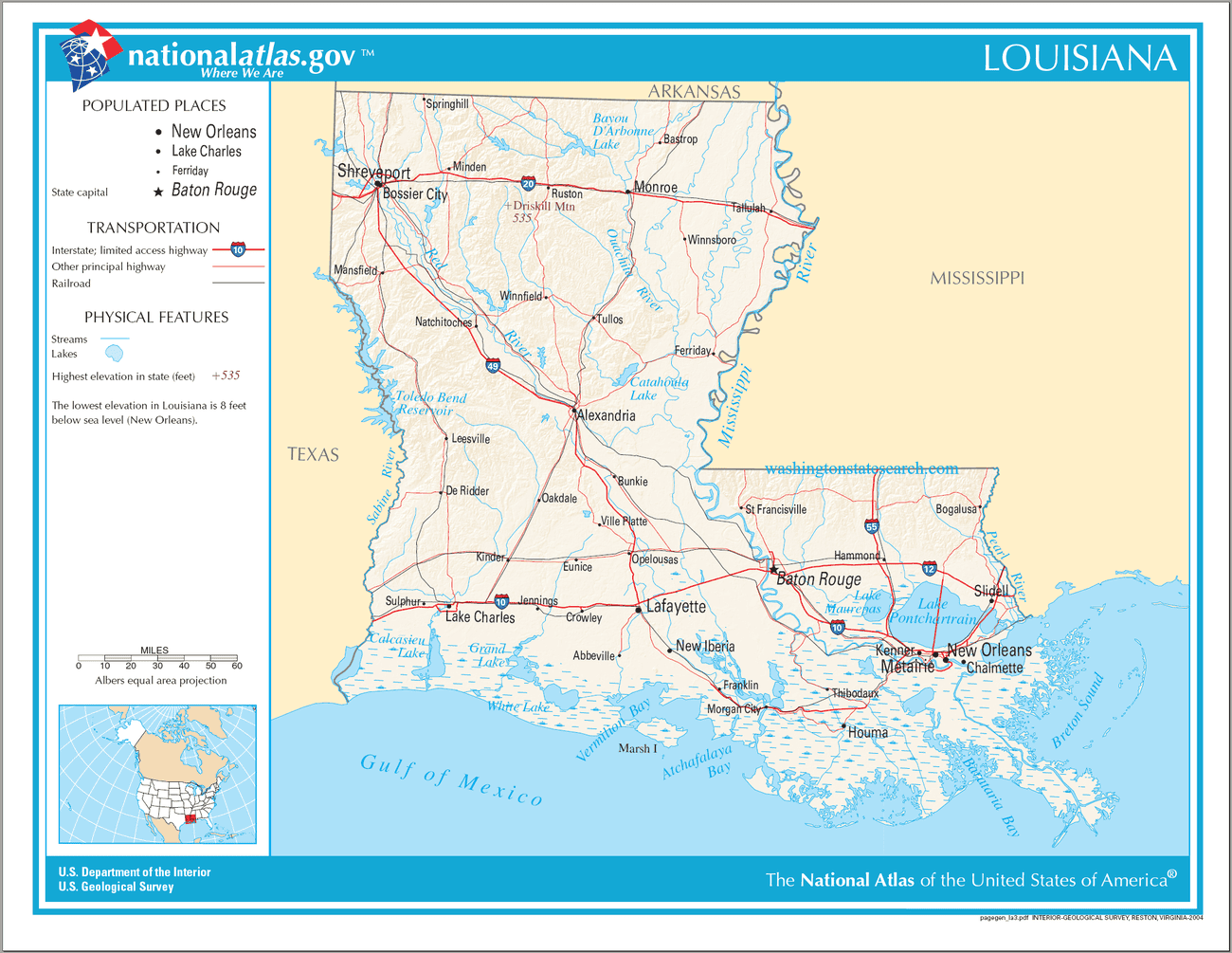
Louisiana State Map
Explore Louisiana with an interactive map featuring Street View, satellite and terrain views. Live weather, local news and location details for Louisiana — plus links to detailed street maps for 490 cities and towns across the state.
Map search is available for a limited number of queries per session to manage costs. Be specific — search precisely for best results.
| State | Louisiana |
| Capital | Baton Rouge |
| Largest City | New Orleans |
| Country | United States of America |
| Statehood | 1812 |
| Nickname | Pelican State |
| Latitude | 30.9711 |
| Longitude | -91.8272 |
| Population | 4,657,757 |
| Cities & Towns | 490 |
| Counties | 64 |
| County Map | Louisiana County Map |
About Louisiana
Louisiana unfolds as a landscape sculpted by water, its terrain a study in subtle gradients and alluvial plains. The long, brown Mississippi River, a constant artery, carves its way through the state, shaping the very soil and offering the lifeblood for its fertile lands. To the south, the coast dissolves into a complex network of bayous and marshes, a watery labyrinth where cypress trees stand sentinel, their knees breaking the surface like ancient secrets. East of the Mississippi, the Florida Parishes offer a slightly higher elevation, a gentle undulation compared to the flat expanses of the delta, but the dominant force remains the water – the Gulf's humid breath, the slow, deliberate flow of countless waterways that define Louisiana's unique geography.
The story of Louisiana is a deep layering of peoples and influences, a narrative woven from the threads of ancient Indigenous nations who first navigated its waterways and understood its rhythms. European contact brought a complex colonial past, with French and Spanish hands shaping its early settlements, leaving behind a legacy of language and custom. The acquisition by the United States marked another significant turn, leading to statehood and a period of profound change. Formative episodes, from the Louisiana Purchase to the Civil War and Reconstruction, have left indelible marks, creating a society that carries the weight and wisdom of its diverse origins, a place where the past is not so much remembered as it is lived.
The economy of Louisiana is intrinsically tied to its natural bounty and strategic location. Sugarcane and rice fields stretch across the fertile plains, testament to a heritage of agriculture that continues to thrive, their cultivation a familiar sight against the wide, open sky. The state's vast coastline and inland waterways also support a significant fishing industry, a crucial part of its livelihood. Furthermore, Louisiana stands as a vital hub for the petrochemical and energy sectors, its position along the Mississippi and its access to the Gulf making it a critical point for transportation and industry. This blend of agricultural tradition and industrial might forms the economic bedrock of the state, a continuous process of production and distribution.
Louisiana possesses a cultural character as rich and complex as its geography. The air itself seems to hum with a unique energy, a palpable sense of time that moves with a different cadence, especially in the languid heat of summer. This is a place where music is not merely heard but felt – the soulful wail of jazz mingling with the infectious rhythm of zydeco, a sound that seems to rise from the very earth. Food is a central ritual, a deeply cherished expression of community and heritage, drawing from a spectrum of influences that have converged here over centuries. In this state, the voice of life is often lyrical, sentences loosened by the pervasive humidity and the easygoing pace, a gentle reminder that some things are best savored slowly.
Louisiana City and Town Maps
A
B
C
D
E
F
G
H
I
J
K
L
M
N
O
P
Q
R
S
T
V
W
Louisiana Maps — Interactive Map, Street View, Weather & Local News
This page provides an interactive Google map of Louisiana (LA) with Street View, satellite and terrain views, alongside links to detailed street maps for 490 cities and towns across the state. The state capital is Baton Rouge and the largest city is New Orleans, with a state population of approximately 4,657,757.
Every city and town map page includes an embedded street and satellite map together with live weather. National Weather Service forecasts are combined with Open-Meteo graphical data including current conditions, an hourly outlook and a 7-day forecast. Local and world news feeds, Wikipedia location summaries and editorially written descriptions are included where available.
Location data is sourced from the USGS GNIS database and the SimpleMaps US Cities dataset, verified by coordinates rather than name matching alone.
