Washington State Volcanics Map
Enter your search query in the box below.
Home Page > Washington State Maps > Washington State Volcanics map
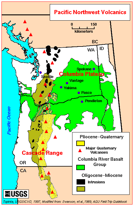
Pacific Northwest Volcanics showing the Cascade Range and Columbia Plateau. The Columbia River Basalt Group (CRBG) is the youngest and most studied flood basalt. The province underlain by the basalt is loosely termed the Columbia Plateau. Such an overall designation is a misnomer, however, for the basalt has been sharply folded and broadly warped, so that its top varies in elevation from slightly below sea level in the Pasco Basin to more than 2.5 kilometers above sea level in the Wallowa Mountains of northeast Oregon.
Washington State Volcanics Map
From the United States Geological Survey