Columbia River Flood Basalts Map
Enter your search query in the box below.
Home Page > Washington State Maps > Columbia River Flood Basalts map
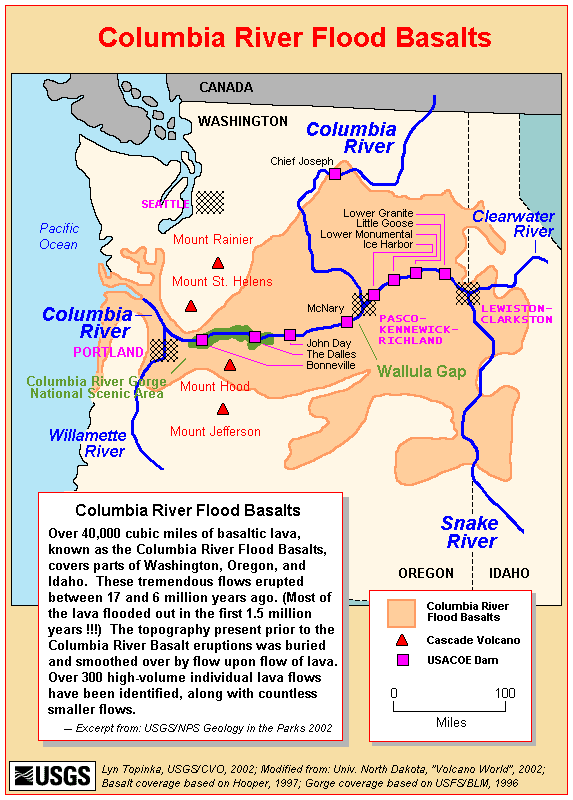
Over 40,000 cubic miles of basaltic lava, known as the Columbia River flood basalts, covers parts of Washington, Organ and Idaho. These tremendous flows erupted between 17 and 6 million years ago. Most of the lava flooded out in the first 1.5 million years. The topography present prior to the Columbia River basalt eruptions was buried and smoothed over by flow upon flow of lava. Over 300 high volume individual lava flows have been identified, along with countless smaller flows.
Columbia River Flood Basalts Map
From the United States Geological Survey