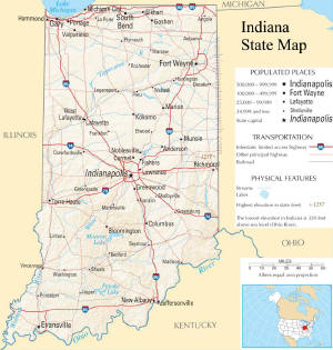
Explore Portage, Indiana, with this interactive street and satellite map. You can “grab” the Portage, IN street map and move it around to re-centre it. You can change between standard map view and satellite map view by clicking the small square in the bottom left-hand corner of the map. You can use the zoom buttons on the lower right side of the map to zoom in or out to street-level detail. You will find live weather, local and world news below.
This interactive map shows the street layout and satellite imagery for Portage, Indiana. Use the Map and Satellite buttons above to switch between street map and aerial imagery views. Use the + and − buttons to zoom in or out, or scroll your mouse wheel while holding the Control key to zoom. On a touchscreen, use a two-finger pinch gesture to zoom in and out.
Click ⛶ Fullscreen to expand the map to fill your screen for a larger view. To return to the normal page view, press the Escape key on your keyboard, click the ✕ Exit Fullscreen button that appears above the map, or on a mobile device tap the back button (Android) or the close icon (iOS).
Drag the map to pan to any area of Indiana or beyond. Switch to Satellite view to see high-resolution aerial photography of Portage and surrounding areas, including streets, buildings, parks and waterways.
| City | Portage |
| State | Indiana (IN) |
| County | Porter |
| Country | United States of America |
| Timezone | Central Time (America/Chicago) |
| Latitude | 41.575871 |
| Longitude | -87.176146 |
| Population | 38,082 |
| Density | 571.6 /km² |
| Incorporated | N/A |
| ZIP Code(s) | 46368, 46403 |
| Area Code | 260 |
| County Seat | Valparaiso |
| School District | Portage Township Schools |
Portage is a locality in Porter County, Indiana, United States. It has a population of 38,082. The population density is 571.6 people per km². Portage is located at 41.5759°N, 87.1761°W. It observes the Central Time (America/Chicago) timezone. ZIP code: 46403.
Portage unfolds along the southern rim of the vast, shimmering expanse of Lake Michigan, a place where the land gracefully yields to the water's edge. It lies 3.2 miles east of Lake Station, IN (from Lake Station, IN: bearing 89°T), and is situated 8.8 miles northeast of Lake. Here, the geography is a study in subtle contrasts: the sandy, wind-sculpted dunes, remnants of ancient shorelines, give way to more settled terrain, a mosaic of urban neighborhoods and the lingering echo of agricultural fields. The air itself carries a distinct character, a blend of the freshwater breeze and the industrial hum of nearby steel mills, a testament to the region's enduring connection to both nature and human endeavor. Even the light seems to hold a unique quality, especially in the late afternoon, when it casts long, softened shadows across the landscape, hinting at the stories held within the land. The history of Portage is deeply intertwined with the industrial might that has defined much of northwestern Indiana, a narrative of growth and transformation that began in earnest with the advent of steel production. Before this era, the area was a quieter place, shaped by the natural forces of the lake and the early settlers who sought opportunity in its fertile soil and strategic location. The local economy, while still bearing the imprint of its industrial past, has diversified, embracing retail, service industries, and a growing residential base that draws from the wider Chicago metropolitan area. This evolution has brought a steady influx of people, each adding their own thread to the economic and social fabric of Portage. Portage’s cultural character is one of pragmatic resilience, a blend of Midwestern friendliness and a forward-looking spirit. While it may not boast ancient cathedrals or storied opera houses, it possesses its own distinctive landmarks, most notably the Indiana Dunes National Park, a breathtaking sanctuary of natural beauty that draws visitors from far and wide. The rhythm of life in Portage is often dictated by the seasons, with summer bringing the allure of the lake and its beaches, and the changing leaves painting the remaining woodlands in vibrant hues. The spirit of community is palpable, often expressed through local events and the shared pride in a place that has steadily built its identity, a quiet testament to the enduring allure of the Hoosier landscape.
Loading news…
Loading news-world…
Loading news-world…
This page provides an embedded street and satellite map of Portage, Indiana — switch between views using the small square in the bottom left-hand corner of the map. Coordinates: 41.575871, -87.176146. Live weather conditions are sourced directly from the National Weather Service, with current observations and a 7-day forecast also powered by Open-Meteo. Real-time local news and world news feeds keep the page current, while a Wikipedia summary or an editorially written description provides background on Portage and Porter County.
Detailed location data for Portage includes the ZIP code (46368), telephone area code (260), county seat of Porter County (Valparaiso), and school district assignment (Portage Township Schools). These are among the most commonly searched location details for any US city or town.
Location data is drawn from the USGS Geographic Names Information System (GNIS) and cross-verified against 2020 US Census records by coordinate proximity — ensuring the correct Portage is identified even where the name is shared across multiple counties or states. Population figures are sourced from the 2020 US Census.
| Page generated | August 2026 |
| Location data | SimpleMaps US Cities Database; coordinates matched to USGS GNIS definitive data |
| Wikipedia validation | Article content matched to USGS GNIS coordinates via Wikipedia geosearch API. Location verified by proximity — not name matching alone. |