Maps of Hertfordshire England
Home > Maps of England > Hertfordshire Maps
Welcome to our Hertfordshire map page. The map of Hertfordshire England that is located below is provided by Google Maps. You can "grab" the electronic map and move it around to re-center the map. You can change between standard map view and satellite map view by clicking the small square on the bottom left-hand corner of the map. Satellite map view utilises orbiting satellite and / or aerial high-resolution photography to display images of the map location to street level detail (really quite amazing). Standard map view shows a traditional street map (also known as a road map). You can use the zoom buttons on the bottom right-hand side of the map to zoom in or out to street level detail. We have digital online maps for most towns and cities on the Maps of England page. We also have a good collection of old school printable maps on the Maps of England page.
A map of Hertfordshire, England
Hertfordshire Maps
I hope you like the Hertfordshire County, England street map / road map situated above.
If you like our website, please consider adding a link to the site. These links help to build website traffic and they are considered a vote of confidence for a site.
Hertfordshire
Hertfordshire; often abbreviated Herts) is one of the home counties in southern England. It is bordered by Bedfordshire and Cambridgeshire to the north, Essex to the east, Greater London to the south, and Buckinghamshire to the west. For government statistical purposes, it is placed in the East of England region. The county covers an area of 634 square miles (1,640 km2). The county derives its name from a hart (stag) and a ford, used as the components of the county's coat of arms and of the flag. Hertfordshire County Council is based in Hertford, once the main market town.
In 2013, the county population was 1,140,700, with Hemel Hempstead, Stevenage, Watford, and St Albans - the county's only city - each having between 50,000 and 100,000 residents.
Elevations are higher in the north and west, reaching more than 800 feet (240 m) in the Chilterns near Tring. The county is approximately the drainage divide of the River Lea and the Colne; both flow south, and both are accompanied by a canal. Hertfordshire's undeveloped land is mainly agricultural and much is protected by green belt. Hertfordshire is well-served with motorways and railways, providing good access to London, the Midlands and the North. The largest sector of the county's economy is services.
From Wikipedia, the free encyclopedia
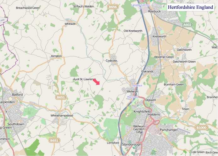
"© OpenStreetMap contributors, CC BY-SA".
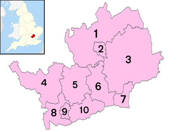
Districts of Hertfordshire
1 - North Hertfordshire
2 - Stevenage
3 - East Hertfordshire
4 - Dacorum
5 - City of St Albans
6 - Welwyn Hatfield
7 - Broxbourne
8 - Three Rivers
9 - Watford
10 - Hertsmere
This file is licensed under the Creative Commons Attribution 3.0 Unported license.